-
 Looking back at Ushuaia from the Beagle Channel
-
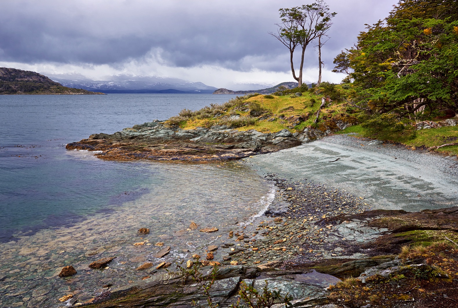
 Book a boat trip that stops at an island in the Channel. Ushuaia is barely visible against the mountains to the far left of this shot.
-
 This was the summer weather when I visited!
-
-
-
Overview & Quick Tips
Located at the cold, windswept tip of South America and surrounded by rugged wilderness, Ushuaia is the most southerly city on earth — a few small settlements lie further south, but with a population of 60,000 only Ushuaia qualifies as a City. Ushuaia is often referred to as The End of the World. Its port hosts companies that run multi-day cruises to Antarctica. You should visit Ushuaia for the surrounding, inhospitable landscape, rather than the city itself.Detailed information
The Short List!
There are three things you must do if you make it down to Ushuaia.
1: Hike coastal hike in Tierra del Fuego National Park.
2: Take a boat cruse on the Beagle Channel.
3: Visit the The Pequena Historia Fueguina museum.
Multiple focal lengths are needed here, from wide angles for landscapes, to a power zoom for bird life and seal colonies.
Climate
Be aware you many have to postpone outings or have then cut short, due to unpredictable weather.
The average temperature in the coolest month of July is 1.6 °C / 35 °F. In the warmest month of January, the average is 10 °C /50 °F. However it often feels colder due to the wind chill factor. Snow in ‘summer’ is not uncommon.
Daylight in Ushuaia varies from 17 hours in summer to just 7 hours in winter. The normal conditions are overcast with dull light.
First Inhabitants
Tierra del Fuego consists of the numerous islands cut-off from the mainland of South American by the Strait of Magellan.
Humans first inhabited the region about 10,000 years ago. Incredibly, despite the cold climate the indigenous Yaghan people wore no clothing, instead they smeared themselves with seal fat and stayed near a constant fire. Even in their canons they kept a flame burning. This fire inspired the naming of the region by European explores, Tierra del Fuego means Land of Fire in Spanish.
In the Yaghan dialect, Ushuaia means, Bay that Penetrates Westward.
Maritime / Prison Museum & Railway,
In the 1860s, an Anglican missionary was established at what was to become the City of Ushuaia. The settlement expand when a prison and railway built. Today the old prison serves and the Maritime and Prison Museum. The railway, which is the most southerly in the world, offers short tourist rides.
The Pequena Historia Fueguina
The Pequena Historia Fueguina (San Martin 152, Primero y Segundo Piso—a short walk for the Ushuaia Port) is a fantastic museum that focuses on the former Indigenous people of the area. Exhibitions are in Spanish and English, allow 1 to 2 hours. You can use your camera inside. Sadly, as of 2015, there is just one last full-blooded Yahgan, she lives in Chile.
I recommend visiting this museum before exploring outdoors, you’ll then have a better appreciation of early human interaction with this hash landscape. There are numerous shell middens and ancient dwelling sites along the coast around Ushuaia and it’s nice to know what you are photographing at when you stumble on one.
Tierra del Fuego National Park.
The best place for costal hiking is the Tierra del Fuego National Park. Access is 11km / 7 miles from Ushuaia and can be reached by car, bus or train. There’s a small entry free.
If you go on a guided tour they can arrange canoeing. The Park has numerous hikes along well marked trails. As little as half a day is enough but you can also do longer hikes that cross the Park. The Paso de la Oveja is a two day trek, and the Sierra Valdivieso Circuit is four days.
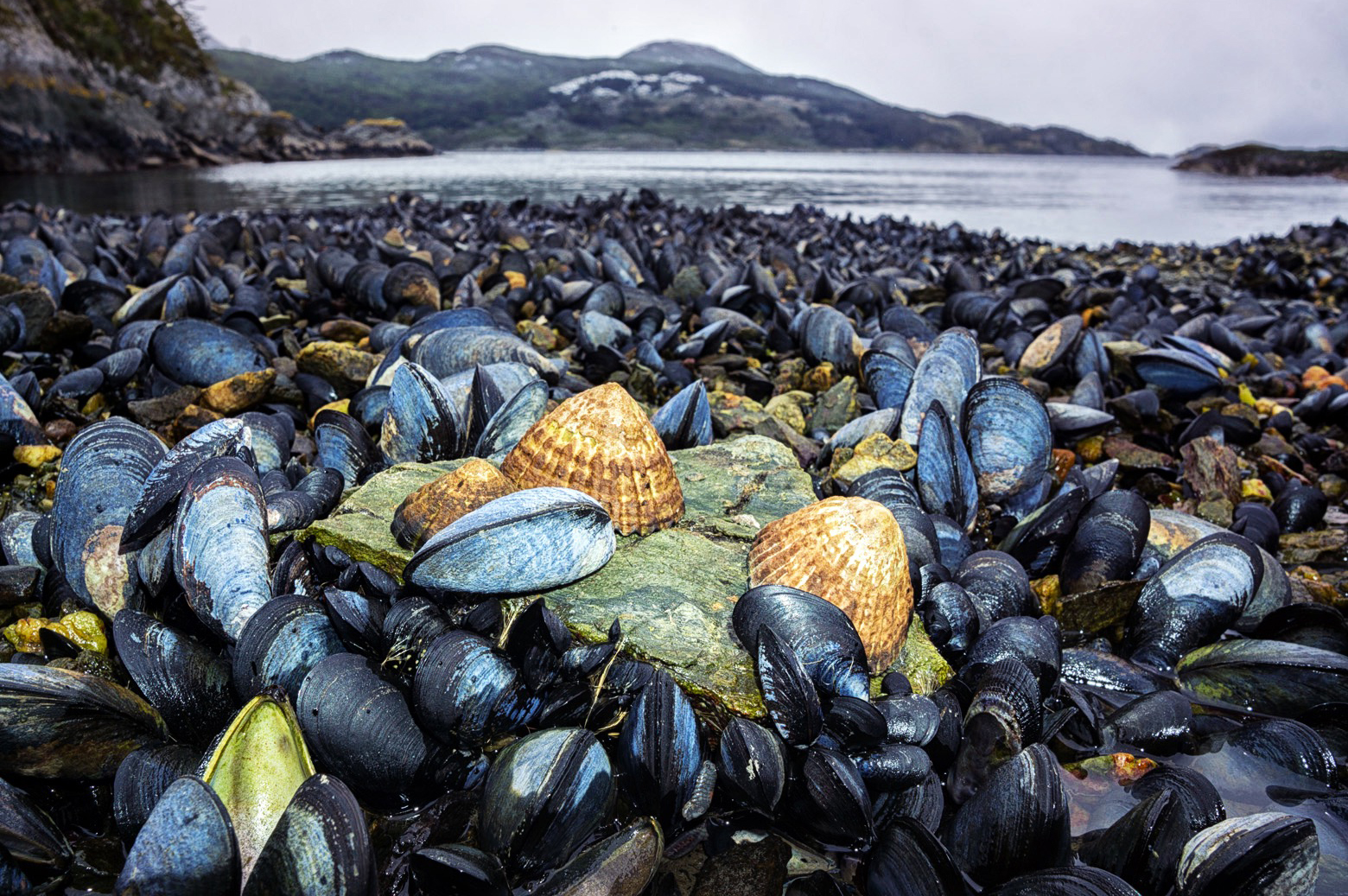
Along the cost you’ll also find abundant muscles and other shells cloning to the rocks. Be sure to kneel down to them, use a wide aperture and get some close ups.
Birds
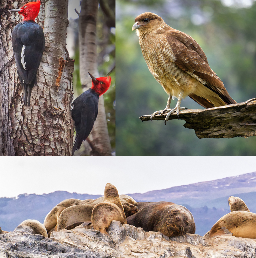
Bird life is abundant in this regions. There are 90 species living in the National Park, with a zoom lens you are bound to snap a few!
The campground in the Park near Lake Roca is frequented by the Chimang Caracara, a bird of prey in the Falcon family.
The Upland Goose is large, white, majestic bird that you’re likely to come across. Finally be sure to listen out for the hammering the Magellanic Woodpecker—a handsome bird with a black body and red head.
Laguna Esmeralda Hike
This hike to a blue coloured glacial lake takes 3-4 hours one way. It begins at Valle de Lopos, you can go there by bus or taxi. It’s meant to be an excellent walk, but alas, we can’t do everything!
Beagle Channel by Boat
Ushuaia is wedged between the forested Martial Mountains and the desolate shores of the Beagle Channel. Take a short boat trip, but expect rough water. Within the channel there are small rocky islands, home to seal colonies. Be sure to book a boat trip that makes a stop on one the larger islands where you can disembark for some minutes for photographs.
Seal Colonies
With the tour boat rocking around in the wind and rain, I was not successful taking photos of these colonies from the boat. Under these conditions, use a fast shutter speed and don’t zoom in too close or else the rolling boat is going to toss your subject right out the frame! You can always crop in and straighten the horizon later.
Les Eclaireurs Lighthouse
Les Eclaireurs Lighthouse is 5 nautical miles from Ushuaia, it’s the normal turn-around point for boat trips. This 22 meter, red and white lighthouse is popular with photographers, however I never made it out there, my boat trip was cut short due to rough water.
Contact Details
- Address: Yaganes 299-399, V9410IHG Ushuaia, Tierra del Fuego, Argentina
Best Times of day to visit
- Best time of day: Any
- Alternative time: Any
Time Required
- 3 days
Send To A Friend
GPS coordinates:
Get Directions
I took a bus from Puerto Natales, crossing the Strait of Magellan on a ferry. The trip was long and most of the landscape along the way was bland compared to other regions Patagonia. Hence I would advise flying to Ushuaia unless you have no time constraints.